| Seeing Earth Through AI: LLM-Augmented Geospatial Research with Satellite Imagery
In this talk, we will cover practical methods for leveraging open-source satellite imagery to extract actionable insights about our planet spanning from climate change monitoring, agricultural optimization, and urban infrastructure planning.
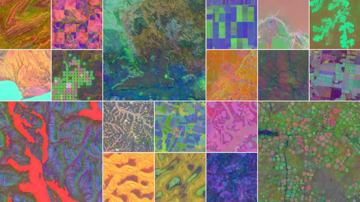
We’ll dive into how AI tooling and Large Language Models (LLMs) can be leveraged to supercharge this process, with a focus on [DeepMind’s open-source AlphaEarth Foundations](https://deepmind.google/discover/blog/alphaearth-foundations-helps-map-our-planet-in-unprecedented-detail/) dataset.
Attendees will learn how to harness this powerful geospatial dataset and apply natural language interfaces to query, interpret, and visualize satellite embeddings at scale. This AI-driven approach transforms raw Earth observation data into real-time, actionable intelligence—streamlining critical workflows in disaster response, land use planning, and global situational awareness. |