|
Regional Planning Commission News for Southeast Louisiana Parishes of Jefferson, Orleans, Plaquemines, St. Bernard, St. Charles, St. John the Baptist, St. Tammany, and Tangipahoa |
|
REAL IMPACT! SHARED PROGRESS! |
|
Draft MTP and TIP Are Now Available for Public Comment
The Regional Planning Commission (RPC) has completed the draft Metropolitan Transportation Plan (MTP) and draft Transportation Improvement Program (TIP). Both documents are now available for public review and comment.
Together, the MTP and TIP provide a coordinated framework for transportation planning and investment across Southeast Louisiana. The MTP establishes the region’s long-range transportation vision and identifies priorities, strategies, and anticipated investments for the next 20 years and beyond. The TIP supports implementation of that vision by identifying transportation projects expected to receive federal funding or require federal approval during the four-year program period.
Planning for Long-Term and Near-Term Needs
The draft MTP and TIP identify strategies and investments intended to:
- Improve connections among communities, jobs, schools, and essential services
- Reduce fatalities and serious injuries for all transportation users
- Preserve and modernize roads, bridges, public transit, and other infrastructure
- Expand transportation options, including transit, walking, and bicycling
- Strengthen resilience to flooding, severe weather, and other disruptions
- Support freight movement and regional economic development
- Advance equitable and accessible transportation investments
Informed by Data and Community Input
Development of the draft plans combined technical analysis with input from residents, local governments, transportation providers, businesses, community organizations, and regional partners.
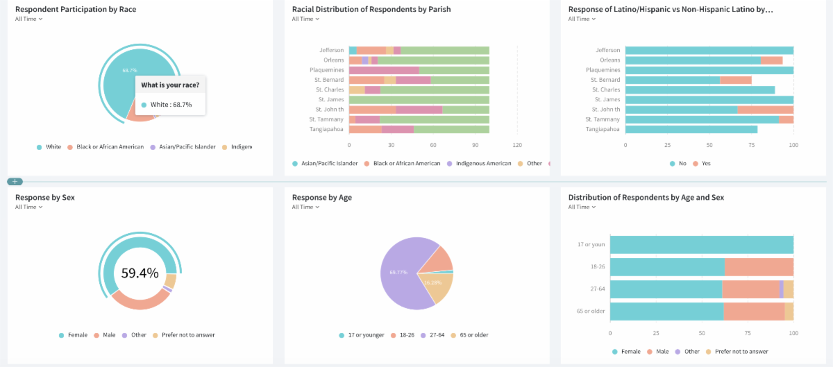
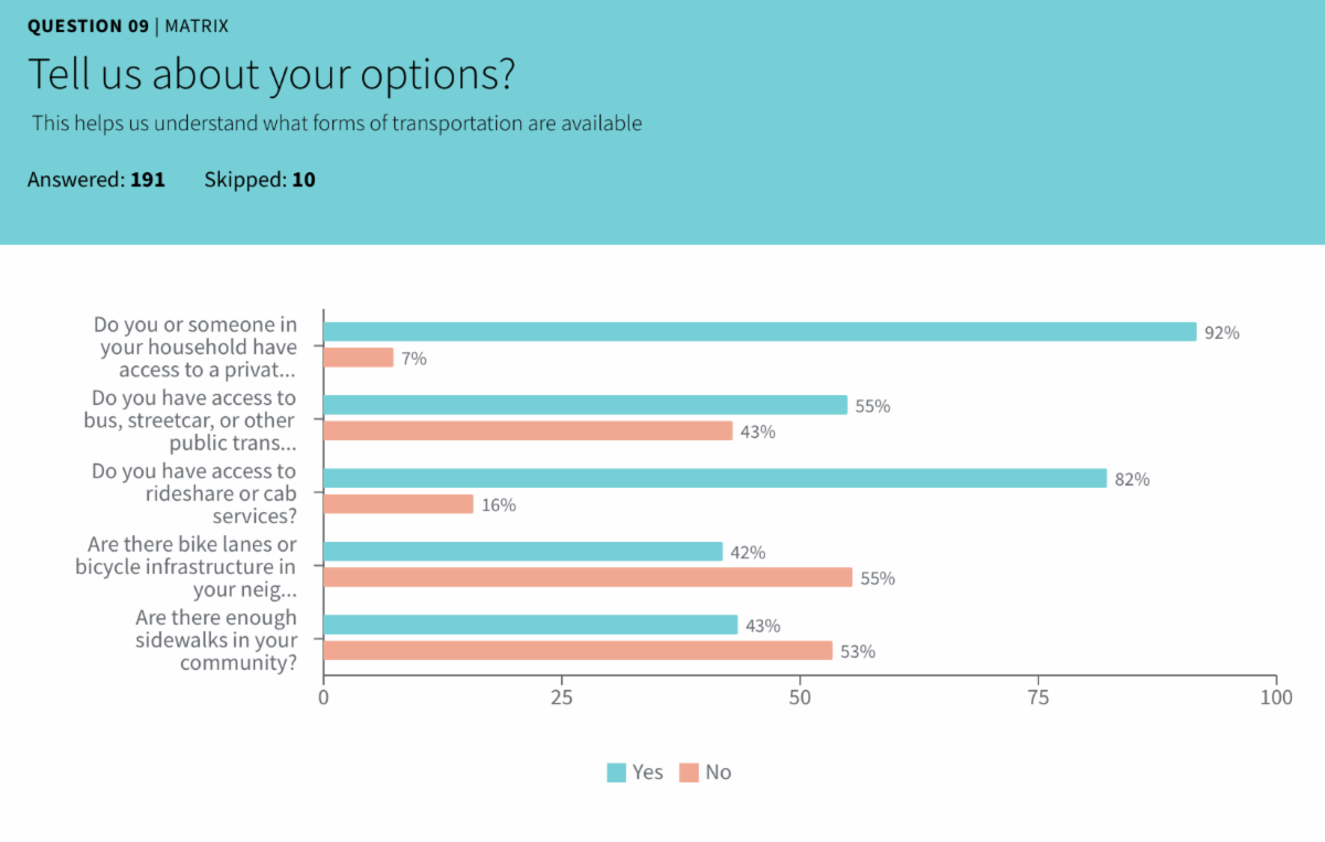
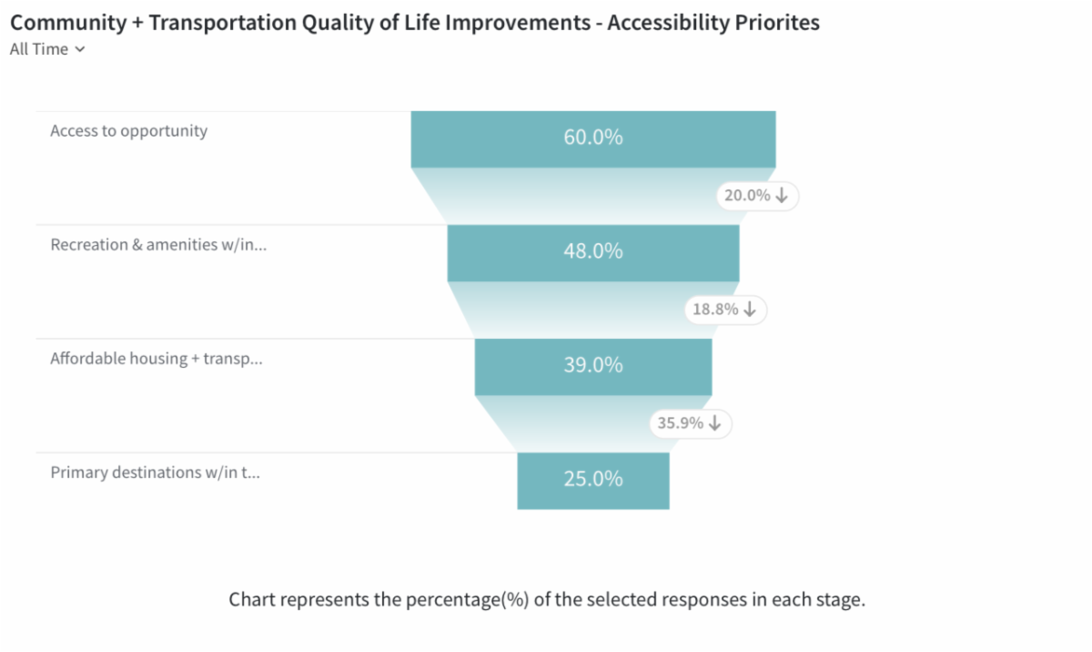
RPC evaluated population and employment trends, travel patterns, safety conditions, infrastructure needs, environmental risks, system performance, and anticipated funding. Feedback collected through surveys, interactive mapping, public meetings, community events, and other outreach activities helped identify local concerns and shape regional transportation priorities.
Review the Draft Plans Residents, local governments, transportation providers, businesses, community organizations, and other interested parties are encouraged to review the draft MTP and TIP and submit comments. Comments may address:
- Regional transportation priorities
- Proposed projects and investments
- Roadway, bridge, transit, bicycle, and pedestrian needs
- Transportation safety and accessibility
- Freight movement and system preservation
- Resilience and environmental concerns
- Other transportation issues that should be considered before the plans are finalized
Your Voice Still Matters Public comments will be reviewed and considered before the MTP and TIP are finalized. This is an important opportunity to help ensure that the region’s transportation plans reflect the needs and priorities of the people who live, work, and travel throughout Southeast Louisiana. RPC appreciates everyone who has contributed to the planning process and invites the public to provide feedback on the draft plans.
|
|
|
|
Notice of Public Comment Period |
|
| To provide comment CLICK ON THE IMAGES ABOVE to review individual access documents and comment forms.
Comments will be accepted through October 12th, 2026
What Happens Next? Following the public comment period, the Commission will review all comments and consider whether revisions are needed before taking action on the proposed Transportation Improvement Program. A summary of comments and responses will be included in the final public participation record.
The Transportation Policy Committee of the RPC is expected to consider adoption of the MTP and TIP at its meeting on October 13th, 2026.
Questions or Additional Information For questions about the Transportation Improvement Program, the public comment process, or available materials, please contact: Tom Haysely Principal Planner Email: thaysley@norpc.org Phone: 504-483-8510 Please include “FY 2027–2030 Transportation Improvement Program” in the subject line of your email.
|
|
Ongoing Projects and Studies! |
|
|
Barriere Road Expansion Study
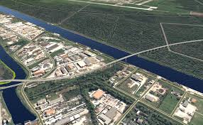
RPC, in coordination with Plaquemines Parish Government, is conducting a conceptual feasibility study to evaluate the potential extension and modification of Barriere Road between LA 23 and Walker Road in the Belle Chasse area. This effort aligns with the Infrastructure Investment and Jobs Act (IIJA), emphasizing improved transportation efficiency, enhanced safety, and planning for all roadway users. The study corridor includes Barriere Road between LA 23 and Walker Road, with the broader study area defined as the land south of the Gulf Intracoastal Waterway, bounded by the hurricane protection levee to the west and LA 23 to the south and east.
|
|
 |
|
Westwego Road Crossing and Pedestiran Connectivty Study
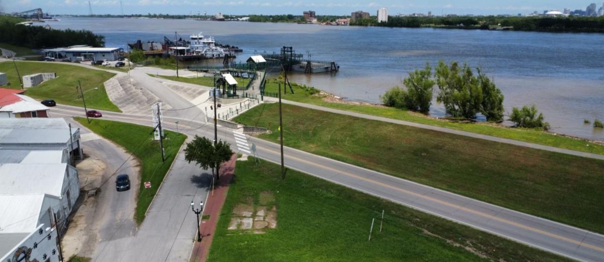
RPC, in coordinafion with Jefferson Parish Government and the City of Westwego is conducfing a conceptual feasibility study for the assessment of rail crossing improvementsand potenfial Complete Streets modificafion of roadways on the Westbank of the Mississippi Riverfront in Jefferson Parish. Rail/highway crossing improvements will focus on the area between the Harvey Canal on the east and 9 Mile Point Rd. on the west. Complete Streets improvements will focus on Westwego between Victory Drive on the east and Louisiana Street on the west, primarily along 4th Street (LA 18)and River Road (LA 541). This evaluation will review and assess appropriate locations for grade separations of the railroad, the incorporation of Complete Streets treatments for vulnerable users, and the potenfial for integrafing design concepts to serve both needs.
|
|
|
|
Barton Avenue Corridor: Bicycle and Pedestrian Accessibility Study
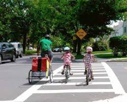
The RPC, in coordination with the St. Charles Parish is conducting a feasibility study for the assessment and potential modification of the corridor immediately adjacent to and including LA 3060 (Barton Ave.) from US 90 to LA 18 which could include travel lane modification, streetscaping, traffic calming measures, introduction and integration of walking and bicycling features, water management and resilience enhancements, and related improvements which would enhance safety, multi-modal use, and improve the quality of life for all users. |
|
|
|
Geospatial Pluvial Flood Risk Geosptail Modeling
As a result of stakeholder input and assessing regional data needs, the RPC recentently kicked off the development of various geospatial datasets and products thatcan assist local policymakers, planners and engineers by providing data driven insights toenhance regional flood resilience and inform infrastructure investments.
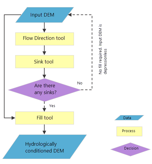
This effort will leverage existing GIS and spatial datasets to quantify land cover and surface runoff potential across the region’s varied landscapes, integrating precipitation data to assess flood vulnerability.
|
|
|
St. Tammany Parish Comprehensive Pedestrian and Bicycle Plan wrapped up late 2025! Working with the Parish the team explored and developed strategies for improving bike and ped in St. Tammany Parish! Click Here to Read Report |
|
|
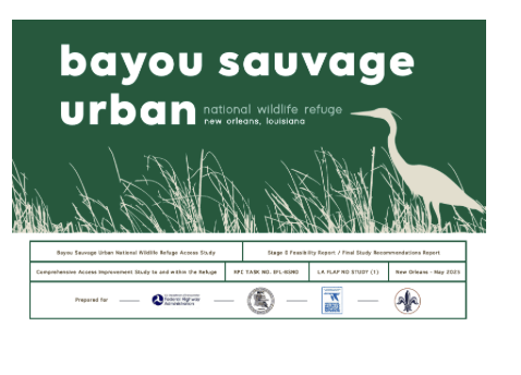
| Bayou Sauvage wrapped up late 2025! Under the Federal Land Access Program the team explored connectivity otpions to the Refuge! Click Here to Read Report |
|
|
|
RPC and TPC Monthly Meeting |
|
Tuesday, April 14, 2026 12:30pm |
|
Regional Transportation Management Center
10 Veterans Blvd, New Orleans, LA 70124
View on map |
|
|
|
|
Coordinated Human Services Group Meeting |
|
Wednesday, April 29, 2026 10:30am |
|
Regional Transportation Management Center
10 Veterans Blvd, New Orleans, LA 70124
View on map |
|
|
|
|
|
Tuesday, May 12, 2026 12:30pm |
|
Regional Transportation Management Center
10 Veterans Blvd, New Orleans, LA 70124
View on map |
|
|
|
| "For special accommodations for this meeting or for anyone who requires an auxiliary aid or service for effective communication, or modifications to policies or procedures to participate in this meeting, should contact RPC’s public outreach coordinator, at 504-483-8513 or mgivhan@norpc.org as soon as possible, but no later than 48 hours before the scheduled event." |
|
|
| 10 Veterans Memorial Blvd New Orleans, LA 70124 504-483-8500 info@norpc.org
|
|
|
|
|